Buying land in Wanaka – 1860s problems
In 1858 the General Assembly of New Zealand passed the Waste Lands Act. Waste Lands had been loosely described as “unoccupied land on which Native Title had been extinguished”. In reality, the situation is a lot more complicated than that.
Land was to be sold for not less than 5/- per acre (this figure subsequently increased) and this opened the door for the farm settlers such as McLean, Roy, Wilkin etc. As we already know, little settlements like Albert Town sprung up, usually at crossing points on the Clutha and the few people that were there, just built on the land at that locality – a simple process. This is all circa 1859-1860.
Also in the background are the subsequent introductions of additional Acts relating to Waste Lands – at least four just in relation to Otago in one four-year period. The rules kept changing!
In 1863, John Connell drew up surveyed plans for towns at Gladstone (John Creek, Lake Hāwea), Newcastle (Albert Town at the junction of the Hāwea and Clutha/Mata-Au Rivers) and Pembroke.
At Pembroke, he surveyed and named streets and sections along the lake front, stretching from Helwick Street through to Roche Street. Pembroke Park was not even thought about. The rest of what we now know as Wānaka was not surveyed into sections, but what was, became classified as Townland. Anything outside that surveyed area was known as Rural Land, yet it is clear in referring to Connell’s map, there was some expectation that the town would be larger in the future (the streets to nowhere).
At least one later map from 1871 strongly suggests that the Wastelands Board had a vision of a much larger town than Connell had mapped out. It showed a rough boundary for the proposed town bounded by Stone Street, Bullock Creek to the east and the Dray Track (now known as Ardmore St).

Connell’s Survey Map - 1863
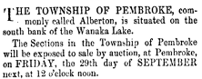
The surveyed land stayed in its natural state, uninhabited for the next two years. Then, in August 1865, the Waste Lands Board for Otago decided to auction off the surveyed sections with the auction to occur on 29 September 1865. It has to be said that the advertisements were confusing, and they even continued to be published in the local newspapers after the auction date.

You might ask the question “Did the Waste Lands Board in Dunedin even know what they were selling let alone where the land was?” And what is Alberton?
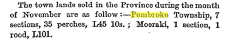
The Upper Clutha History Society have found no evidence that auctions actually took place. Certainly nothing is reported in the newspapers, though this appeared in December 1865:
That aside, until Russell and Hedditch came along in 1867/8 and built the Wanaka Hotel, no other buildings had been erected in the surveyed area. The site selected for the hotel was un-surveyed land and clearly not part of the Townland area. It is important however, to consider Connell’s map, as previously suggested there was a probable intention to survey a larger area sometime in the future, i.e. some of the streets lead to vacant rural land. Russell was clearly an astute businessman and he had identified a piece of land that would be ideal for a hotel with a magnificent view stretching out from Roys Bay to the mountains beyond.
In 1866 a new Act, The Otago Wastelands Act came into being and it limited the land that could be purchased as being either Townland or Rural Land. It was not Townland that Russell wanted, but there was a clause requiring Rural Land to be of at least 50 acres, more than 4 times what he wanted (12 acres). It is likely that the Otago Waste Lands Board granted him a licence to occupy (or some similar agreement) at least 4 acres on which to build the hotel, along with an expectation that at some future point in time, a survey would be undertaken by the Board to extend the Townland Area, and then he would be able to apply to purchase the land. Otherwise, Russell would have been in clear breach of the legislation and subject to a substantial fine for having occupied the land and built a building thereon. Then again, maybe they decided just to take the risk and build – who knows!
Then along comes the Otago Waste Lands Act 1872, which introduced a new category of land – Suburban Lands. This covers land adjacent to surveyed Townlands that might well become Townlands at some future time. Possibly, Russell sees an opening here for him to purchase the freehold, except that the legislation only allows for surveyed land to be included and it must be auctioned. In 1873, at his own expense, he surveyed 12 acres of land, and in early 1874 petitioned the Board to purchase this land. This was declined but he returned to the fray and continued to apply. It is possible that the 12 acres he applied for was the area bounded roughly by Bullock Creek, Ardmore Street, and a point eastward of Brownston Street.
To cut a long story short, eventually the Board authorised a new survey to be completed (see the 1875 Map), but this did not include the whole 12 acre block Russell wanted. It did include 4 acres of the ground on which the hotel stood. It is interesting to see the outline of the hotel and stables buildings outlined on the survey map.
It is likely that politics and bureaucracy had some influence on the delays that Russell experienced in getting a final decision on the land purchase, except that it did not occur until after he died in 1877.
It might seem that not a lot has changed over the last 150 years!